Book-led accuracy
Locations and routes are based on the written descriptions and travel information from the series.
A map built from the books
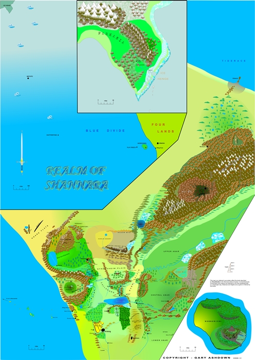
A full-scale digital interpretation of the Four Lands, assembled from locations, journeys, distances and geographical clues across the Shannara series.
The work behind the world
The map was developed by collating geographical information from the novels and comparing the routes taken by characters throughout the Four Lands.
Travel times by foot, horse, cart, Roc and airship were used to estimate distances and keep locations coherent. Mountains, coastlines, islands and volcanic regions were positioned to reflect the descriptions in the books rather than being added simply for decoration.
Made for close exploration
The map is designed to be viewed on screen at high zoom or printed as a large poster. The original scale was designed around approximately 1 mm to one mile across the main landmass, with a broader ocean scale for the crossing toward Parkasia.
Locations and routes are based on the written descriptions and travel information from the series.
The full-resolution image can be taken to a print shop for an A0-size poster or explored digitally.
The Four Lands, surrounding seas, islands and distant regions are brought together in one coherent view.
Digital download
Purchase the high-resolution JPEG for £5. After payment, PayPal sends the download-page address and password to the email address used for the transaction.
This is an independently created fan map. Shannara and related names remain the property of their respective rights holders.